Everything you need to know about Bali's most popular sunrise trek — the route, costs, guide requirements, and what the experience is actually like.
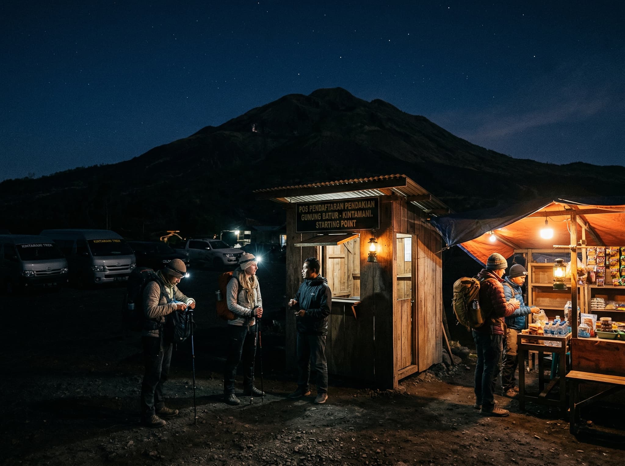
The alarm goes off at 1:30 AM. The coffee hasn't kicked in. The van is already waiting. This is how most people meet Bali's most-climbed volcano — groggy, slightly skeptical, and wondering if any sunrise is worth this.
It is.
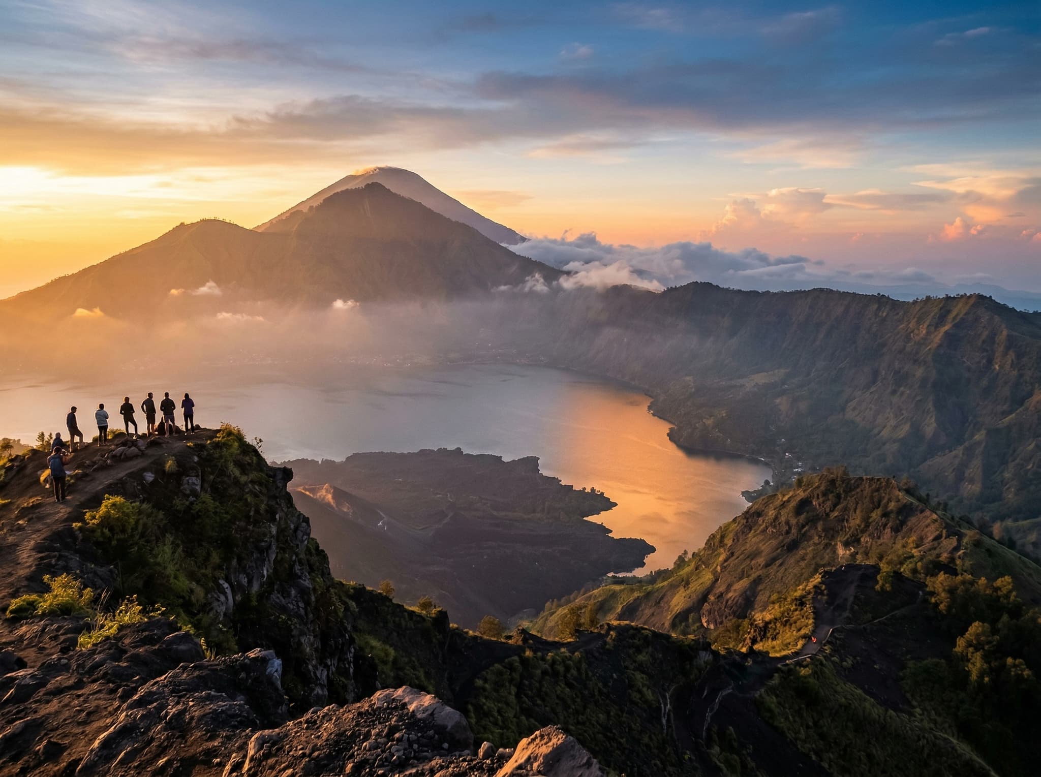
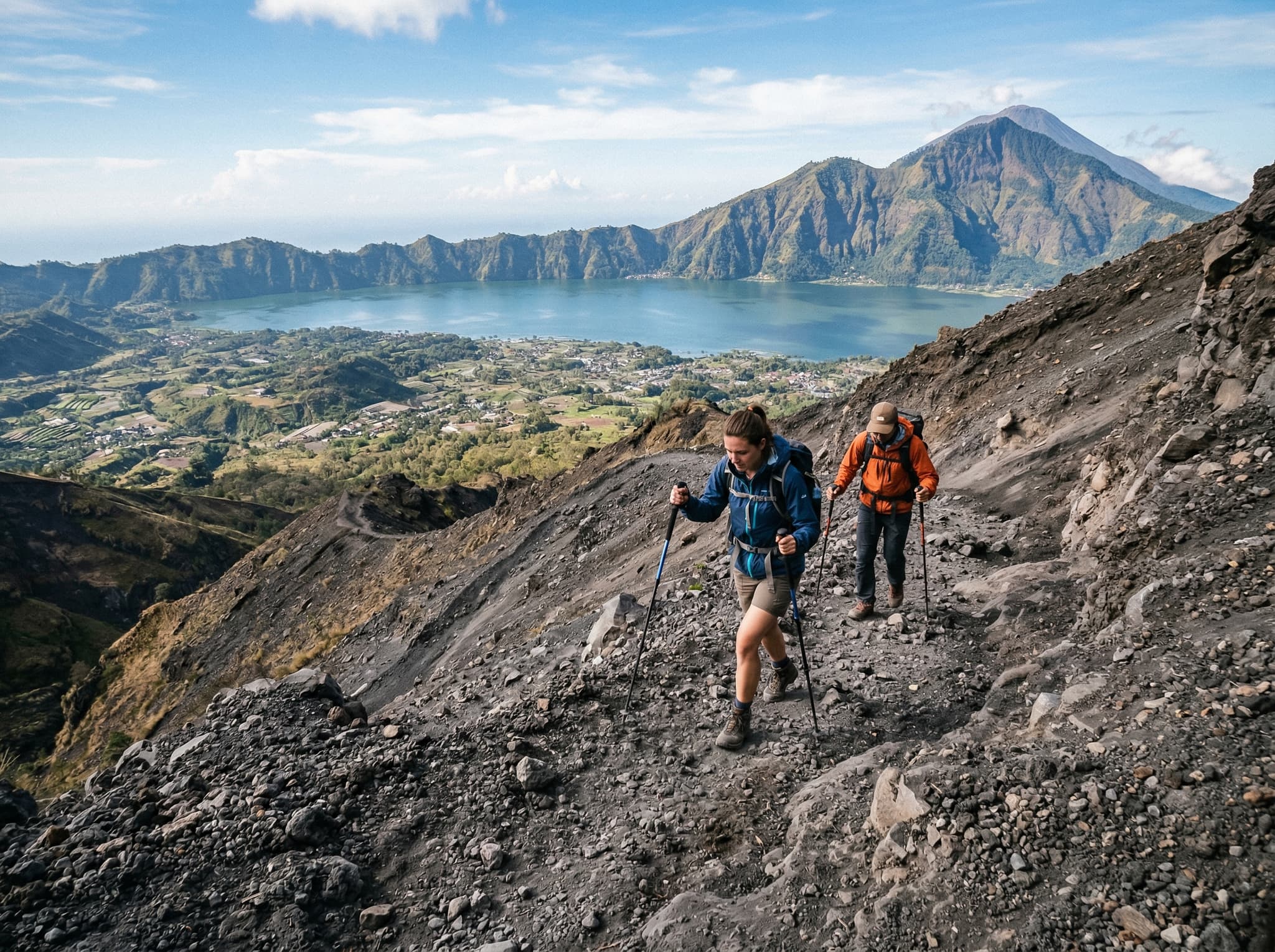
Mount Batur is an active volcano sitting inside an ancient caldera, with Lake Batur curving along its base and the larger mass of Mount Agung rising behind it to the east. At 1,717 meters, it's not Bali's tallest peak — that distinction belongs to Agung — but it's the one most visitors actually climb. The summit is moderate enough for anyone with basic fitness, dramatic enough to feel like an accomplishment, and positioned perfectly for a sunrise that, on clear mornings, spreads gold across the caldera lake and out toward the coast.
Around 300 to 600 people make the climb each day. That number should tell you something about both the appeal and the reality.
The Trek Itself
Most treks follow the same rhythm. A van collects you between 2:00 and 3:00 AM depending on where you're staying — Ubud is about 1.5 hours away, south Bali closer to 2.5. You arrive at the trailhead around 3:30 AM, pay the entry fee, meet your guide, and start walking in the dark.
The ascent takes 1.5 to 2 hours. The trail is steep in places, loose gravel and volcanic rock underfoot, with some stair-like sections that feel steeper than they are when you can't see much beyond your headlamp beam. It's not technical climbing. It's a hike — but a real one, not a stroll. The final push is the hardest, and by then your legs know they've been working.
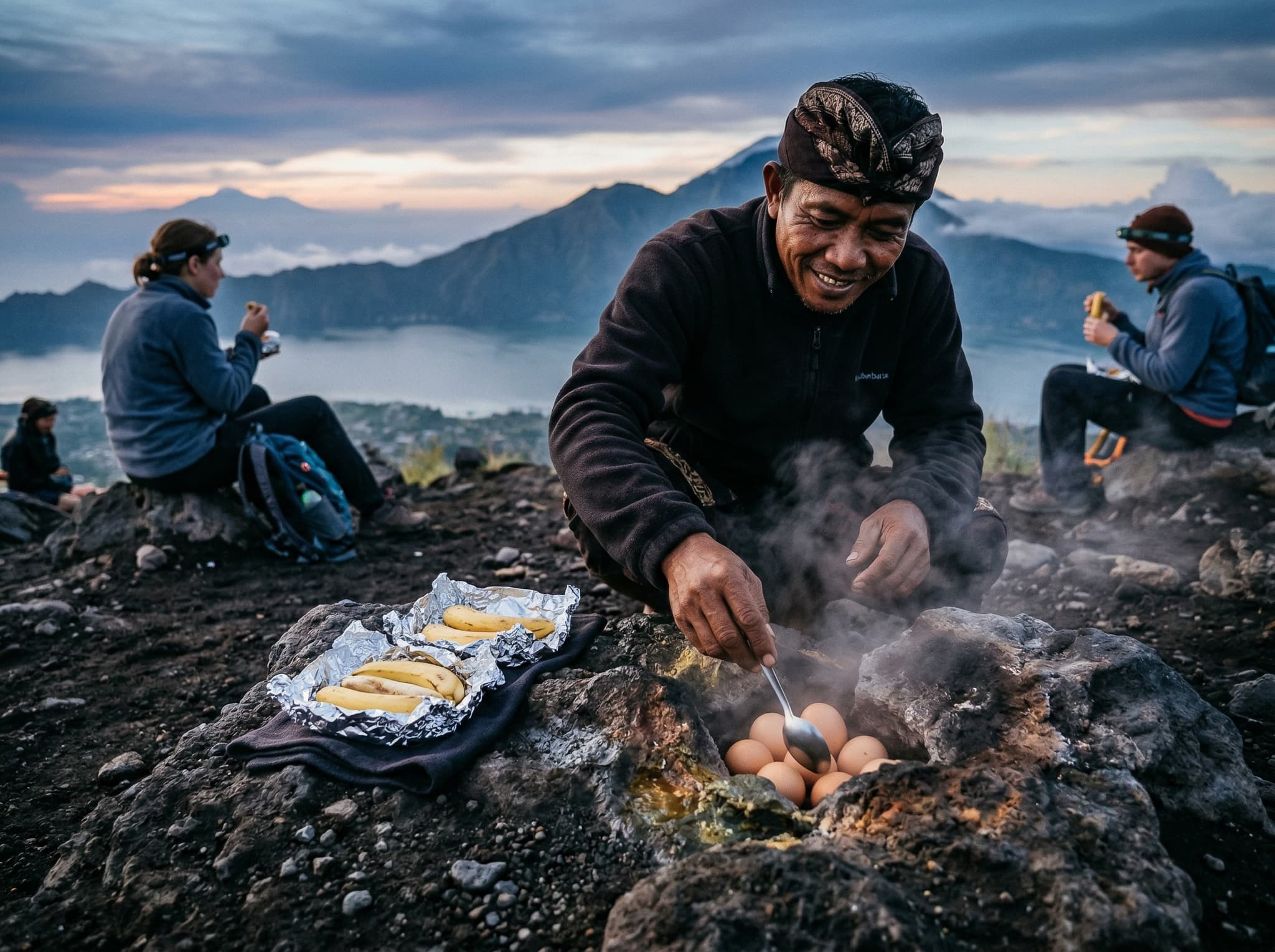
You reach the summit by 5:30 or 6:00 AM. The temperature drops to 10–15°C, which feels colder than it sounds when you're damp from the climb and the wind picks up. Most guides prepare a simple breakfast up top — banana sandwiches, hard-boiled eggs cooked in volcanic steam vents. You eat, you watch the light change, and for a few minutes the crowd thins out in your awareness.
The descent takes 1 to 1.5 hours and is harder on the knees than the ascent. Loose gravel on steep downhill sections demands attention. Trekking poles help if you have them.
Trek Timeline
Hotel Pickup
2:00–3:00 AM
Trailhead Start
3:30–4:00 AM
Summit Arrival
5:30–6:00 AM
Ascent Duration
1.5–2 hours
Descent Duration
1–1.5 hours
Total Outing
6–8 hours (including transport)
The Guide Requirement
A registered guide is mandatory. No national law explicitly bans solo trekking, but the Kintamani trekking association enforces the rule through checkpoints at the trailhead base. Show up without a guide and you'll be turned around. This isn't negotiable in practice, and trying to circumvent it creates problems you don't want at 3:30 in the morning.
The system has its critics — it's a local monopoly, and quality varies. But the guides know the trail in total darkness, carry emergency lighting, and handle logistics that would be genuinely difficult to manage alone at that hour.
What It Costs
Pricing Breakdown
Entry Fee (BKSDA)
IDR 100,000 (~USD 6–8), cash only
Group Sunrise Trek
USD 20–35/person
Private Trek
~USD 80/person
Trek + Hot Springs
~USD 50/person
Hot Springs (separate)
~USD 20
Group packages typically include the guide, entry fee, hotel transfers, breakfast, flashlight, and trekking poles. Book through local operators or platforms like Klook and Viator — prices cluster between USD 20 and 39. Private treks cost more but let you set the pace and avoid the convoy feeling.
The hot springs combo is worth considering if you've never soaked in volcanic thermal pools. Your legs will thank you.
Getting There
Transport from Ubud
Drive Time
1.5–2 hours
Private Taxi (one-way)
~USD 45
Private Taxi (round-trip)
~USD 70
Scooter Rental
USD 4.50–6.50/day
No public buses run this route. Most visitors book a tour that includes transfers — simplest option, especially given the 2 AM departure. If you're riding a scooter, the mountain roads are dark, winding, and cold at that hour. Possible, but not pleasant.
Safety and Volcanic Activity
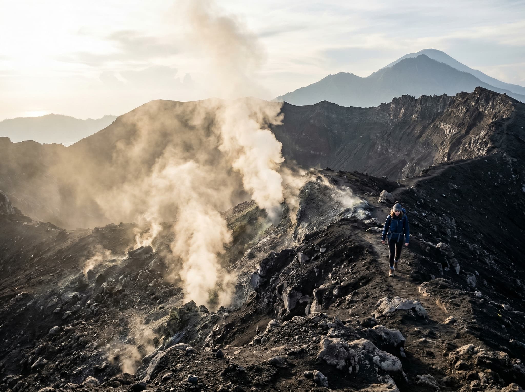
Mount Batur last erupted in 2000 — a minor event with no impact on surrounding villages. As of late 2025, the volcano sits at Level 1, Indonesia's lowest alert level. Fumarolic plumes and steam vents near the crater are normal geothermal activity, not warning signs. A permanent 500-meter exclusion zone around the 1994 crater applies at all alert levels, and guides route around it.
Twenty-two earthquakes were recorded near the volcano in 2025, up to magnitude 4.4. The volcano remained quiet throughout. Check PVMBG (Indonesia's volcanology center) for current status before booking if conditions concern you.
What to Bring
Sturdy shoes with ankle support — not sandals, not fashion sneakers. A headlamp or strong flashlight. At least one liter of water. A light jacket or fleece for the summit. Layers you can peel off during the climb. Gloves if you run cold. Small cash for the entry fee and summit vendors.
Is It Worth the Hype?
Mount Batur is crowded, commercialized, and begins at an hour that feels personally offensive. It is also genuinely beautiful. The caldera is vast. The light, when it arrives, does what no photograph quite captures — it moves across the lake and the ridgeline in real time, shifting from grey to amber to full morning in minutes.
The trick is knowing what you're signing up for. This isn't wilderness solitude. It's a shared experience on a well-worn trail with hundreds of other people who also set an alarm they regretted. And somehow, standing at the top, none of that diminishes the view.