Nusa Penida's dramatic sea cliffs, manta ray dives, and hidden beaches reward travelers who stay longer than a day trip from Bali.
For years, Nusa Penida was the island Balinese fishermen went to and tourists didn't. It sat just 12 kilometers off Bali's southeast coast — visible from Sanur beach on a clear day — but it might as well have been another country. The roads were terrible, the infrastructure was minimal, and there wasn't much reason to go unless you were a diver chasing manta rays.
That changed, dramatically, around 2017. Instagram discovered Kelingking Beach — that dinosaur-shaped cliff plunging into turquoise water — and Nusa Penida went from obscure to overrun in about eighteen months. Today it's one of the most-visited day trip destinations from Bali, which is both the best and worst thing that's happened to it.
The best, because the tourism money has paved roads, built guesthouses, and created an economy beyond seaweed farming. The worst, because most visitors experience Nusa Penida as a frantic checklist — Kelingking, Angel's Billabong, Broken Beach, back on the boat by 3 PM. The island deserves more than that.
What Nusa Penida Actually Is
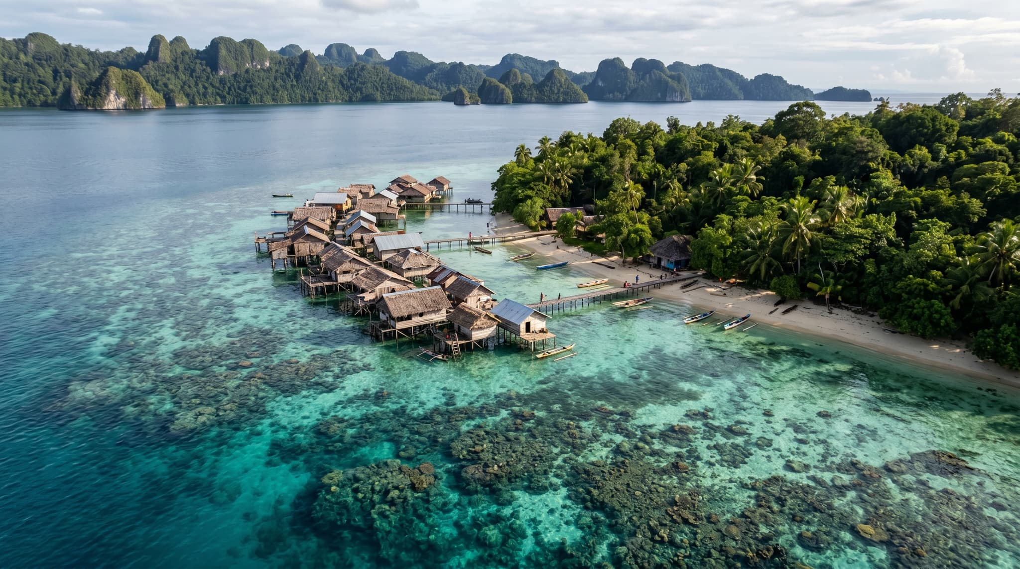
Nusa Penida is the largest of three islands (along with Nusa Lembongan and Nusa Ceningan) that form a small archipelago off Bali's Klungkung coast. At roughly 200 square kilometers, it's about the size of Washington, D.C. — large enough that getting around takes real time, especially given the road conditions.
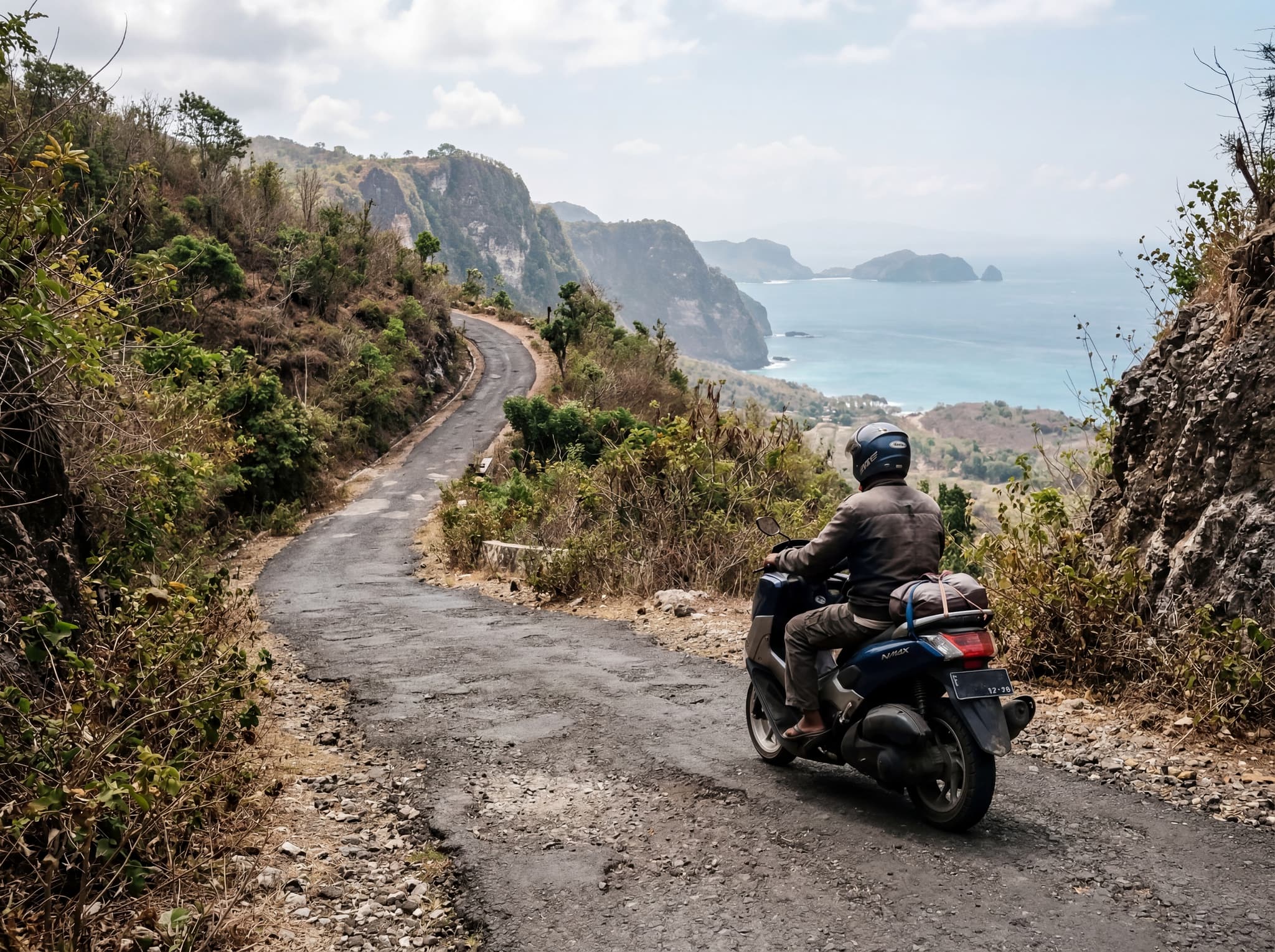
The geography is what makes it special. The island is essentially a raised limestone plateau, and its southern coast is a continuous wall of sea cliffs dropping 100 to 200 meters into the Indian Ocean. The north coast is gentler — sandy beaches, mangroves, calmer water. This north-south divide shapes everything about how you experience the island.
Island Essentials
Size
~200 km²
Population
~60,000
Main Town
Toyapakeh (west) / Sampalan (north)
Getting There
Fast boat from Sanur, 30–45 min
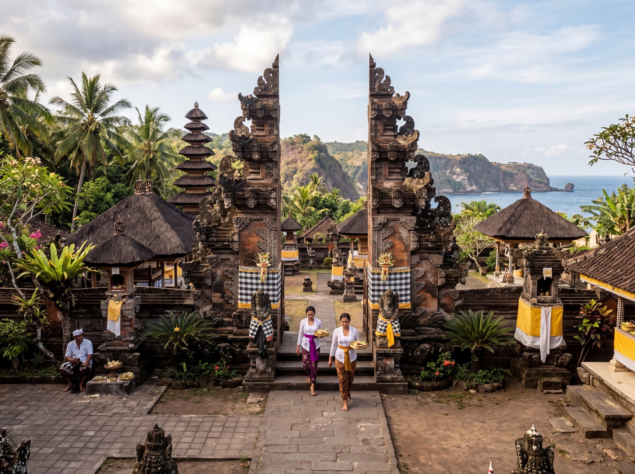
Culturally, Nusa Penida has always been distinct from mainland Bali. It was historically considered a place of spiritual power and exile — Balinese kingdoms sent criminals and undesirables here. The island's main temple, Pura Dalem Ped, is one of the most important in Balinese Hinduism, dedicated to the demon king Ratu Gede Mecaling. Many Balinese make pilgrimages here, and the spiritual significance of the island predates tourism by centuries.
The Cliffs and Beaches
The south and west coasts are where the dramatic scenery lives. Kelingking Beach remains the headline attraction — a steep limestone headland that, viewed from above, resembles a Tyrannosaurus rex in profile. The viewpoint is accessible and genuinely spectacular. The beach below is reachable via a steep, eroded trail that takes about 30–40 minutes to descend. It's not casual — the path is narrow and exposed in places, and the climb back up in tropical heat is punishing.
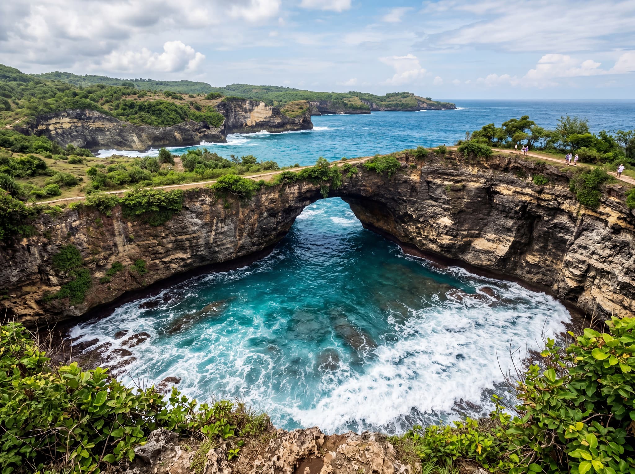
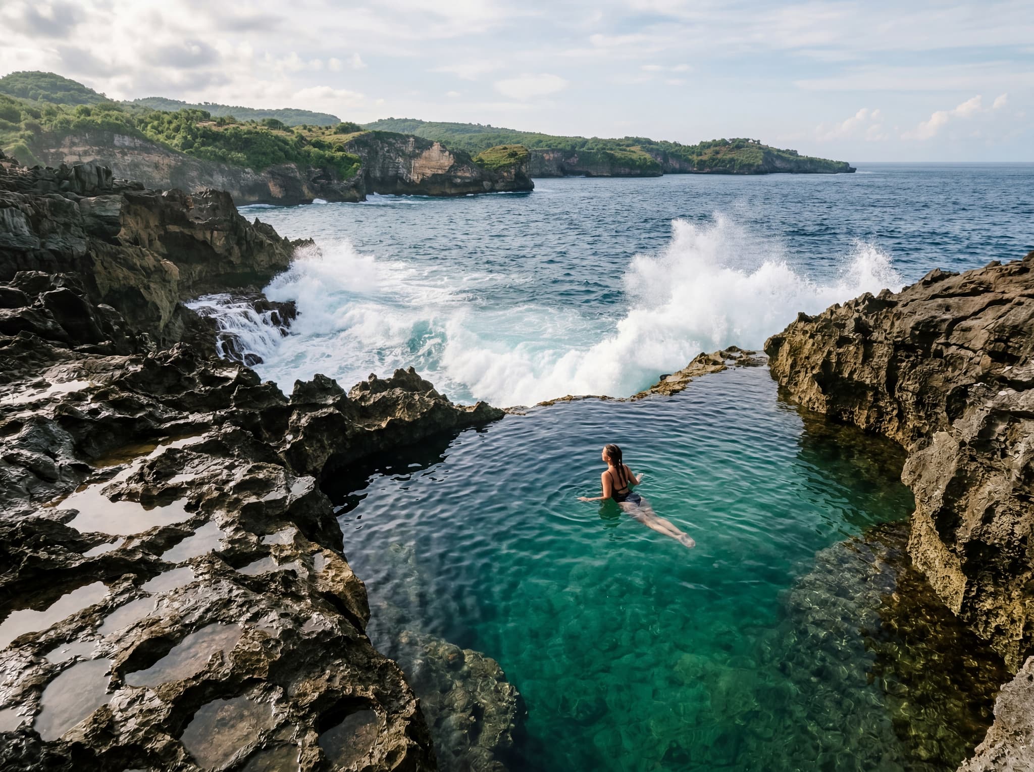
Broken Beach (Pasih Uug) is a natural rock archway forming a circular cove where the ocean surges through a tunnel in the cliff. You can't swim here — it's a viewpoint — but the geology is striking. Angel's Billabong, nearby, is a natural infinity pool carved into the rock shelf at the cliff's edge. Swimming is possible at low tide during calm conditions, but waves have swept people off the rocks here. Check conditions carefully and don't take risks.
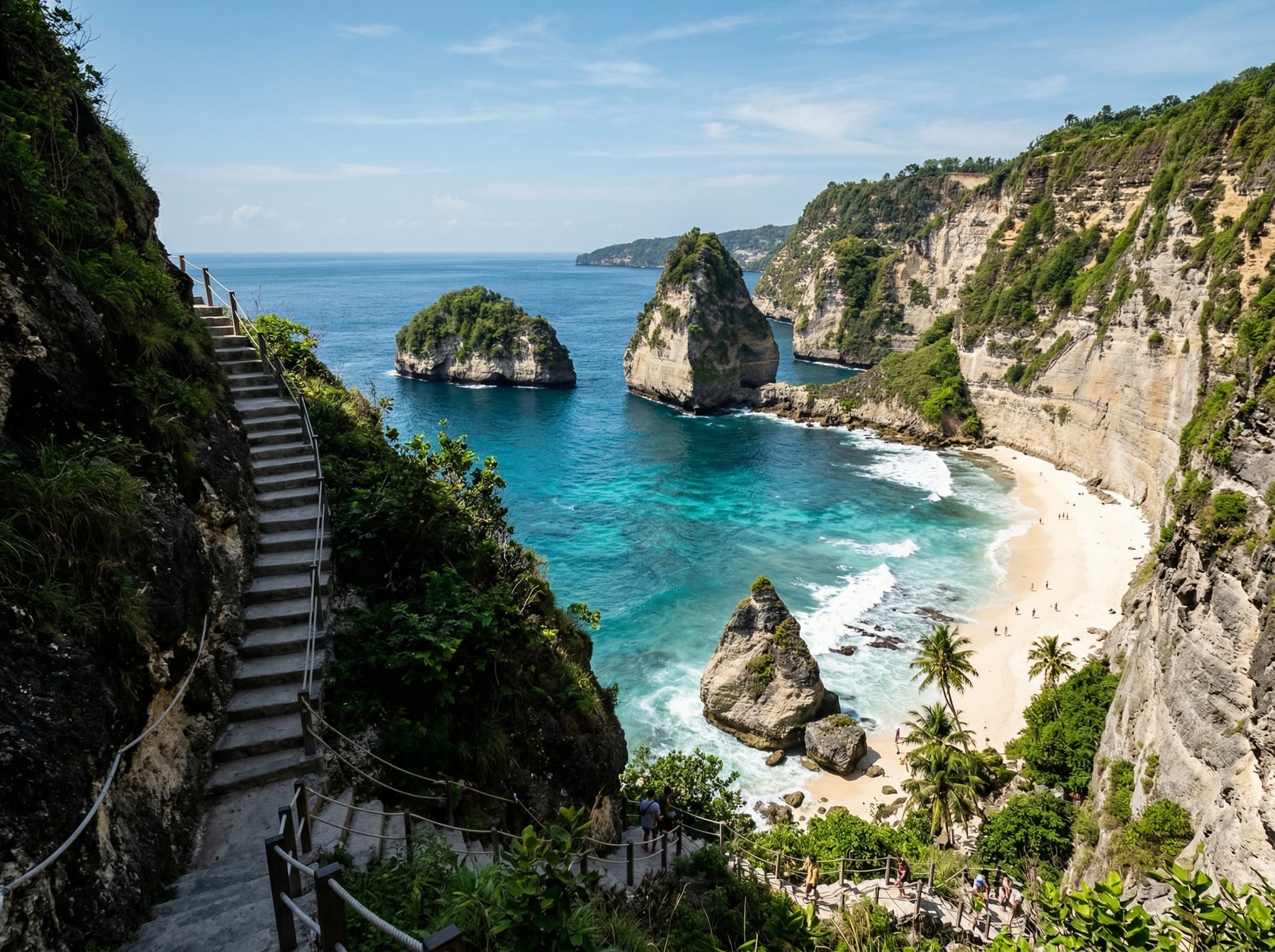
On the east side, Atuh Beach and Diamond Beach sit at the base of towering cliffs, accessed by steep concrete staircases carved into the rock. These are among the most photogenic beaches in Indonesia — white sand framed by jagged limestone pinnacles — and they're less crowded than the west coast sites simply because they're harder to reach.
Underwater Nusa Penida
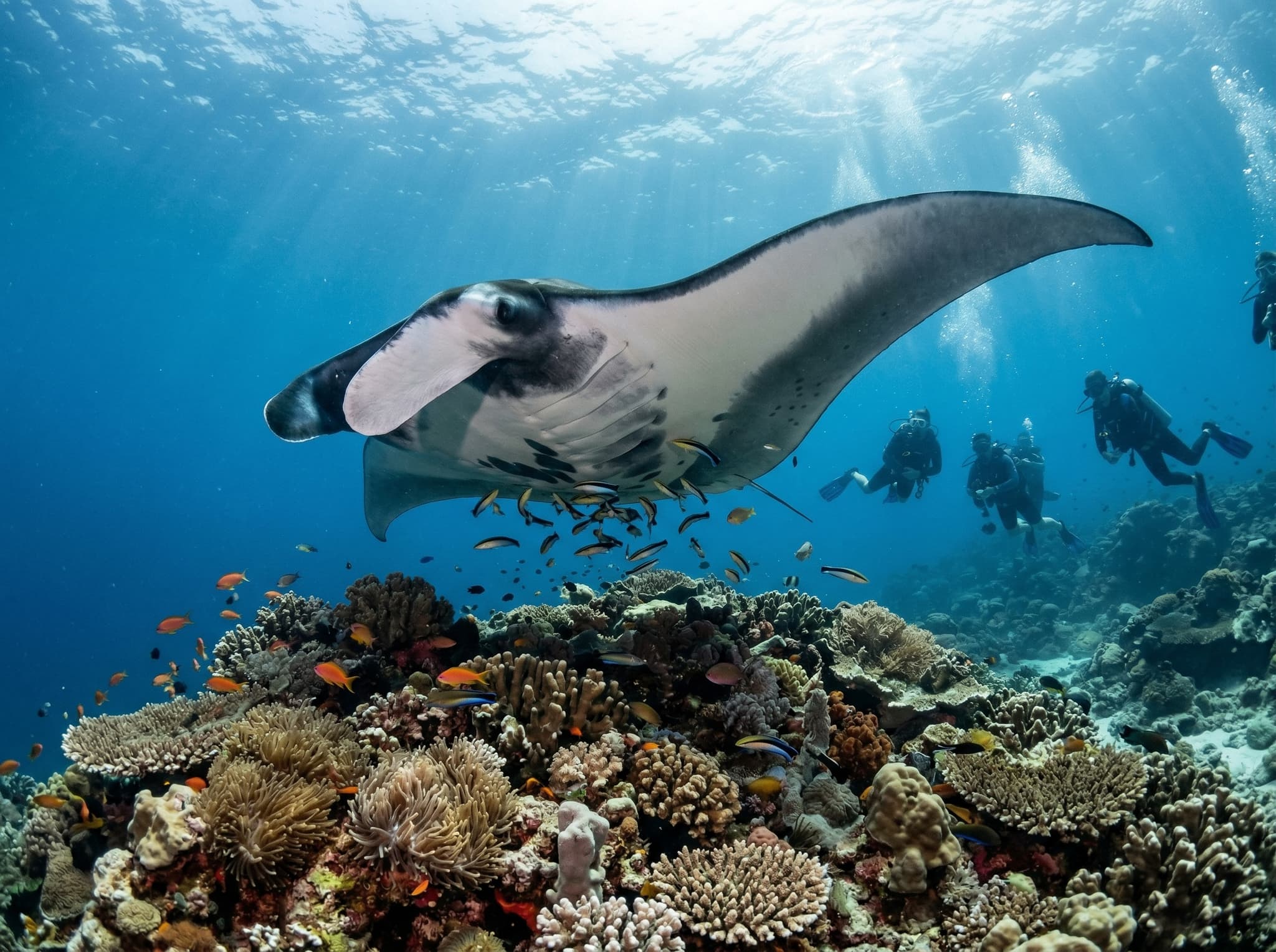
The waters around Nusa Penida are arguably more significant than the land. The island sits at the edge of the Indonesian Throughflow — a massive ocean current that pushes warm Pacific water into the Indian Ocean — and the nutrient-rich upwellings support extraordinary marine life.
Manta Point, off the southwest coast, is one of the most reliable places in the world to dive or snorkel with oceanic manta rays. The mantas come to cleaning stations on the reef, where smaller fish remove parasites, and encounters are common year-round. Between July and October, the cold upwellings also bring ocean sunfish (mola mola) to the dive sites around Crystal Bay — bizarre, prehistoric-looking fish that can reach three meters across.
Diving & Snorkeling
Key Sites
Manta Point, Crystal Bay, Gamat Bay
Manta Season
Year-round (best April–Oct)
Mola Mola Season
July–October
Water Temp
20–28°C (thermoclines common)
The currents here are strong and unpredictable. This is not beginner diving territory — thermoclines can drop water temperatures by 8°C in seconds, and downcurrents are a real hazard. Dive with a reputable operator and be honest about your experience level.
Staying on the Island
The day-trip approach — which most visitors take — is the least satisfying way to experience Nusa Penida. You spend more time on boats and in cars than you do at any single location. Staying at least two nights lets you visit sites in the early morning before the day-trippers arrive, and it gives you time to explore the quieter north and east coasts.
Most accommodation clusters around Toyapakeh and the northwest coast, with options ranging from basic homestays to mid-range hotels. Don't expect Bali-level hospitality infrastructure — this is still a developing tourism economy, and that's part of its appeal.
The Bigger Picture
Nusa Penida's rapid tourism growth has outpaced its infrastructure. Waste management is a visible problem — plastic litter along roads and at some beaches is hard to ignore. Fresh water is scarce on the limestone plateau. The island's coral reefs, while still impressive, face pressure from boat traffic and anchor damage.
In 2010, the waters around the three Nusa islands were designated a Marine Protected Area, covering over 20,000 hectares. Enforcement has been inconsistent, but community-based conservation programs — particularly around manta ray protection — have gained traction. Several dive operators contribute to reef monitoring and cleanup efforts.
Nusa Penida is at the stage where tourism could still go either way. It could develop thoughtfully, with the revenue funding conservation and infrastructure. Or it could follow the pattern of so many Southeast Asian islands — loved to death before anyone figures out how to manage the crowds. Staying longer, spending locally, and choosing operators who invest in the island's future is the small but real thing visitors can do to push the balance in the right direction.