How to reach and hike Puncak Dafalen in Raja Ampat's Fam Islands — trail details, what to expect at the summit, and how to plan the trip.
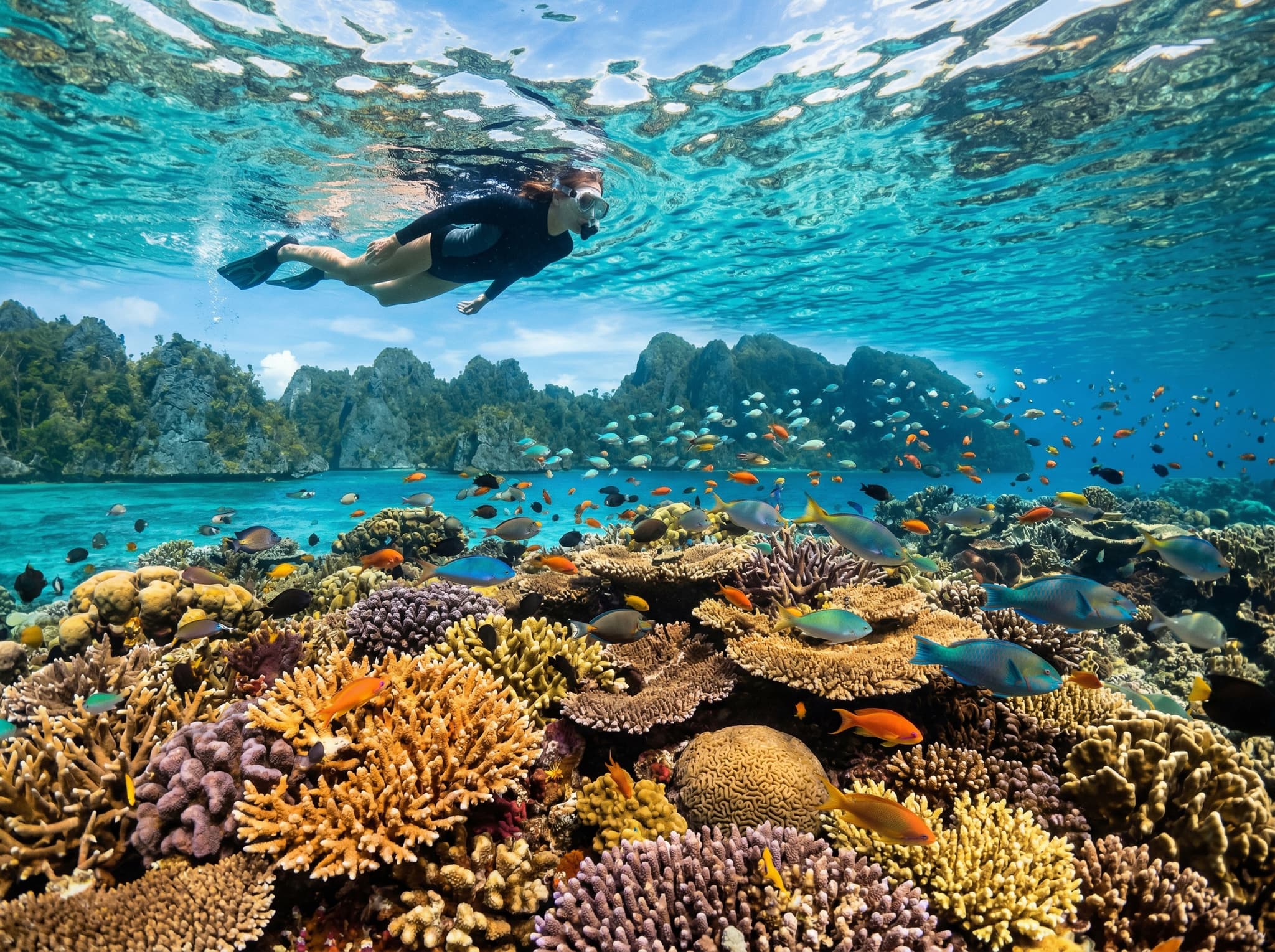
Raja Ampat has no shortage of superlatives. The archipelago off the northwestern tip of New Guinea contains the highest recorded marine biodiversity on Earth — more coral species in a single reef survey than some entire ocean basins. But the thing about Raja Ampat that catches most visitors off guard isn't what's under the water. It's what you see when you climb above it.
Puncak Dafalen, perched on one of the small karst islands in the Fam Islands cluster, is the viewpoint that delivers on everything Raja Ampat promises. From its summit, the archipelago unfolds beneath you in a panorama of lagoons so vivid they look digitally saturated — emerald shallows giving way to deep cobalt channels, limestone islands rising from the water like the knuckles of a submerged hand. It's the kind of view that makes you understand why this corner of Indonesia has become one of the most sought-after destinations in Southeast Asian adventure travel.
Getting There: The Fam Islands by Boat
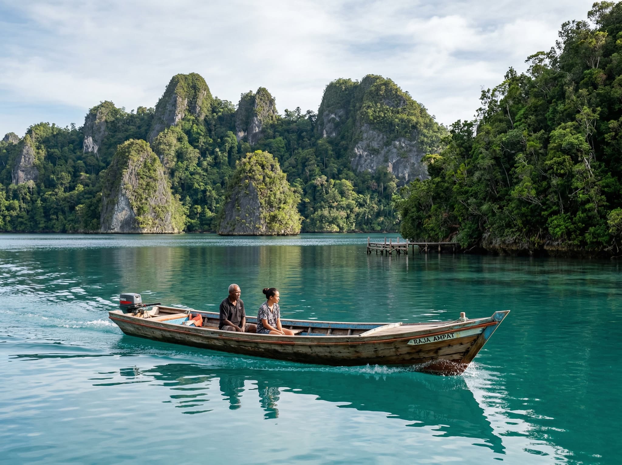
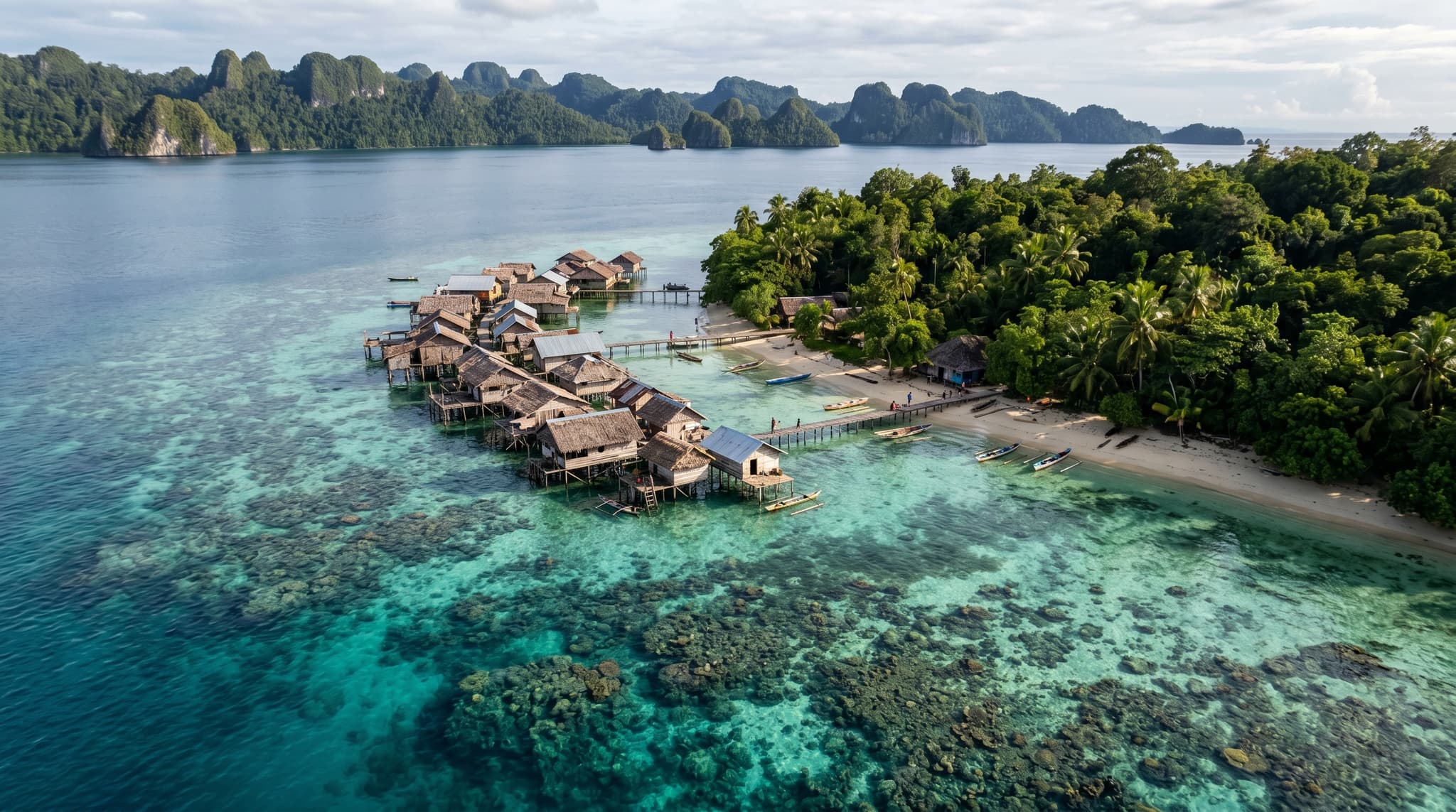
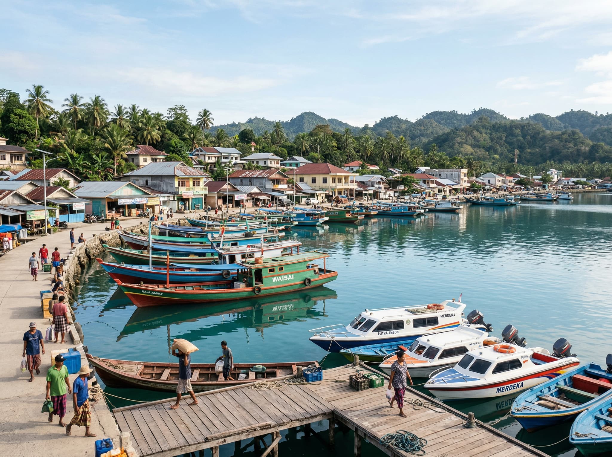
There's no casual way to reach Puncak Dafalen. The Fam Islands sit in the central part of Raja Ampat's marine protected area, roughly two to three hours by speedboat from Waisai, the regency capital. Most travelers reach the trailhead through one of three arrangements: a multi-day liveaboard cruise that includes Fam Islands as a stop, a day trip chartered from Waisai, or a guided excursion organized through a local homestay on a nearby island.
The boat drops you at a small wooden dock at the base of the island. From there, the trail begins immediately — and so does the climbing.
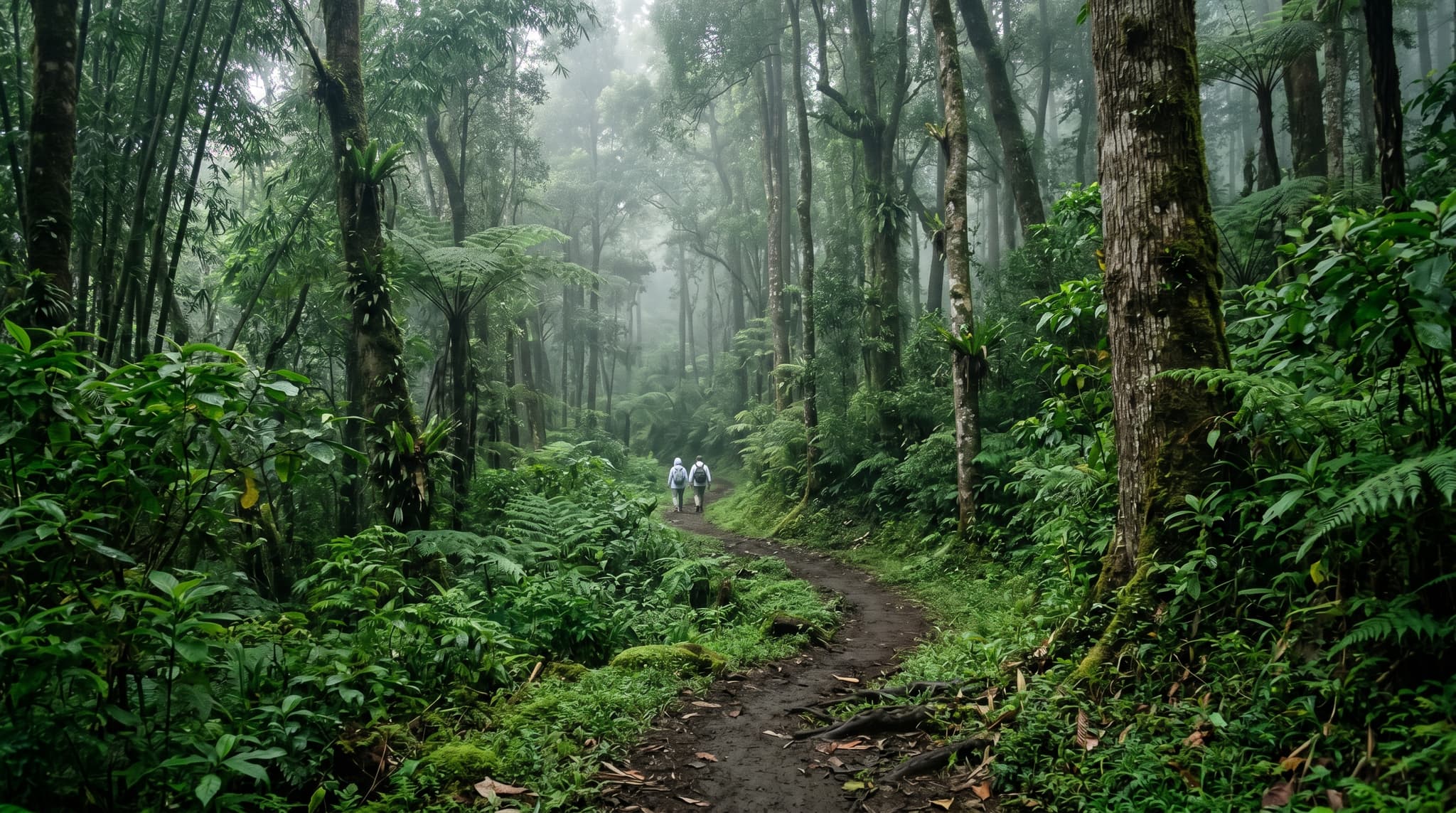
The Hike: Short, Steep, Worth Every Step

Puncak Dafalen's trail is not long. The summit sits roughly 200 meters above sea level, and the path covers that elevation in under a kilometer. What it lacks in distance, it compensates for in gradient. The route climbs steeply through dense tropical forest on a trail that alternates between packed earth, exposed tree roots, and sections of rough-hewn wooden steps.
Trail Details
Elevation
~200 meters above sea level
Trail Length
Approximately 700–800 meters one way
Difficulty
Moderate to strenuous (steep, uneven terrain)
Facilities
Basic wooden railing on steepest sections; no water or restrooms
The humidity is the real challenge. Even in the relatively cooler morning hours, the combination of equatorial heat and dense canopy cover means you'll be drenched within ten minutes. Bring at least a liter of water per person — there's nothing at the top, and the boat dock below won't have vendors either.
The final stretch involves a series of wooden platforms and staircases built into the karst rock. These are maintained by local communities who manage access to the site, but "maintained" is relative — expect some wobble, some missing planks, and the general character of infrastructure in a remote archipelago. Sturdy footwear with grip matters here. Flip-flops are a poor choice.
The View from the Top
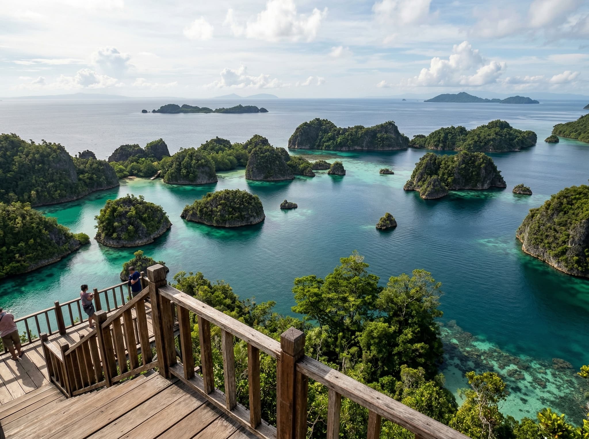
Then you arrive, and the hike stops mattering.
The summit platform — a simple wooden deck barely large enough for a dozen people — opens onto a 270-degree panorama of the Fam Islands lagoon system. Below, the water shifts through impossible gradients of color: pale turquoise over sand, deep green over seagrass, navy blue where the channels drop to depth. Karst islands, draped in vegetation so thick they look upholstered, rise from the water in every direction. On clear mornings, you can trace the contours of reefs beneath the surface, their shapes visible from altitude like topographic maps drawn in coral.
This is the image that appears on Indonesian tourism posters, on the cover of dive magazines, on the Instagram accounts that convinced you to come to Raja Ampat in the first place. Seeing it in person doesn't diminish it. If anything, the scale — the way the lagoon system extends further than any photograph can capture — makes the real thing more impressive than the image.
What Most Visitors Combine It With
Puncak Dafalen rarely stands alone on an itinerary. The Fam Islands are one of Raja Ampat's premier snorkeling and diving areas, and most boats that bring you to the viewpoint trailhead will also stop at nearby sites on the same outing.
The sheltered lagoons around the Fam Islands offer some of Raja Ampat's best shallow snorkeling — healthy hard coral starting at knee depth, blacktip reef sharks patrolling the channels, and the kind of fish density that makes you wonder if someone stocked the reef for your benefit. Melissa's Garden, a renowned coral garden on a nearby reef, is frequently paired with a Dafalen hike as a half-day combination.
Common Combination Stops
Melissa's Garden
World-class coral reef; snorkeling and diving
Fam Islands Lagoon
Sheltered snorkeling with reef sharks and mantas
Penemu Viewpoint
Alternative karst viewpoint on nearby Penemu Island
Penemu Viewpoint, located on neighboring Penemu Island, offers a similar karst-and-lagoon panorama and is sometimes visited on the same day. The two viewpoints complement each other — Penemu looks out over a heart-shaped lagoon, while Dafalen's vista is broader and more dramatic. If you have to choose one, Dafalen is the consensus pick among guides and repeat visitors.
Practical Considerations
Raja Ampat's marine entry permit (called the PIN, or Kartu Jasa Lingkungan) is required for all visitors and covers access to sites including Puncak Dafalen. As of 2024, the permit costs IDR 1,000,000 (~$65) for foreign tourists and is valid for one year. It can be purchased at the entry permit office in Waisai upon arrival.
The trail has no formal operating hours, but access is effectively limited to daylight and dependent on sea conditions for the boat journey. During the wet season (May–September), rougher seas can make the crossing to the Fam Islands uncomfortable or occasionally unfeasible — though Raja Ampat receives rain year-round and "dry season" is a generous term.