Raja Ampat's blue water mangroves defy expectations — crystal-clear turquoise water, limestone karst roots, and thriving marine life in Indonesia's most remote paradise.
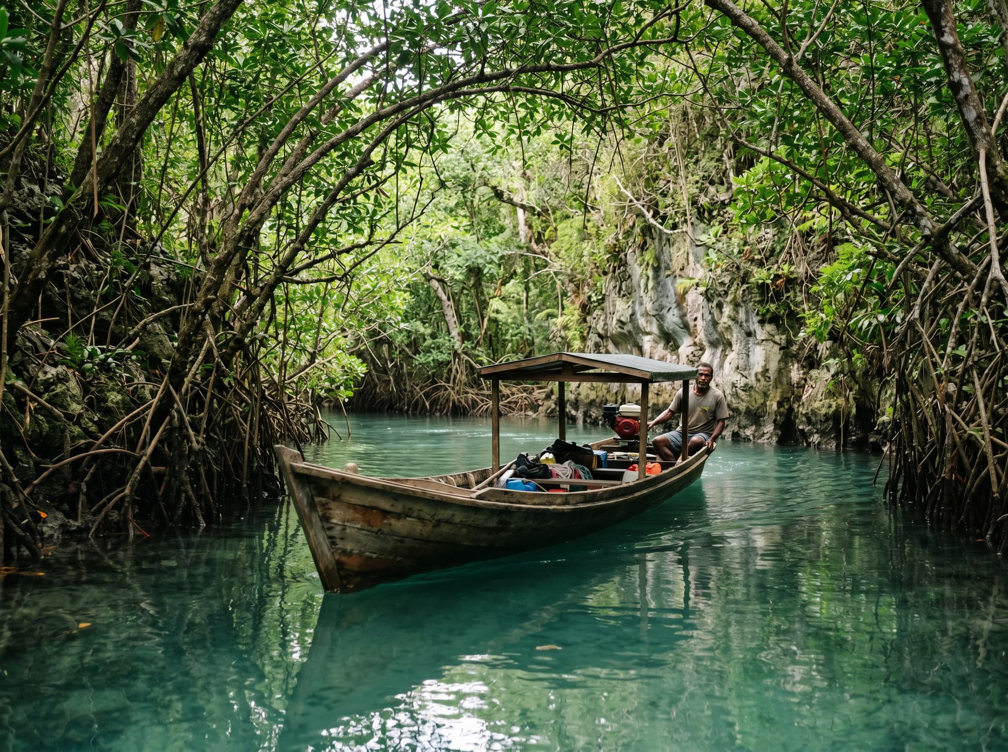
Most mangroves grow in murky tidal flats — brackish water the color of strong tea, tangled roots disappearing into mud. That's the image most travelers carry, and it's accurate for the vast majority of mangrove ecosystems worldwide. Which is exactly why the blue water mangroves of Raja Ampat stop people mid-sentence.
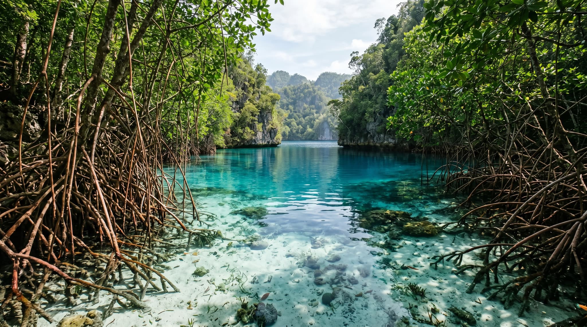
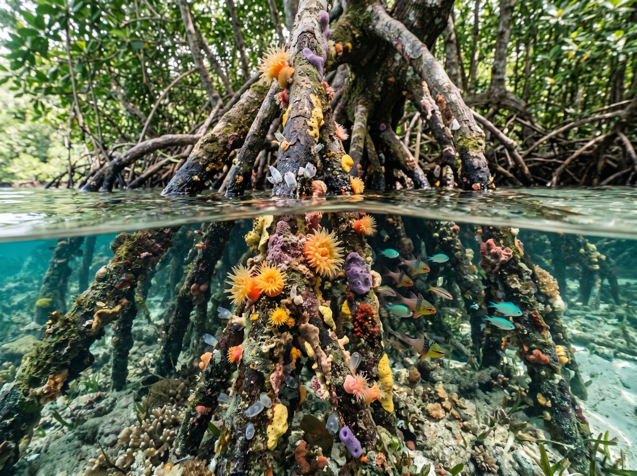
Here, mangrove roots plunge into water so clear it looks artificially filtered. The seafloor is visible three or four meters down — white sand, coral rubble, the occasional sea star. Schools of juvenile fish weave between the roots in water that shifts from turquoise to deep cobalt depending on the angle of the sun. It's a visual contradiction that doesn't quite compute until you're floating in it.
Why the Water Is Blue Here
The clarity isn't magic — it's geology and geography working together. Raja Ampat's blue water mangroves grow along limestone karst shorelines rather than the silty river deltas where most mangroves establish themselves. There's no significant freshwater runoff carrying sediment into these channels. The substrate is coralline sand and rock, not mud. Tidal flushing through narrow channels between the karst islands keeps the water circulating and clean.
The result is a mangrove ecosystem that functions the way all mangroves do — as a nursery for juvenile reef fish, a buffer against coastal erosion, a carbon sink — but in water conditions you'd normally associate with an open-ocean snorkel site.
What Makes These Mangroves Different
Substrate
Limestone karst and coral sand (not mud)
Water Source
Tidal ocean water, minimal freshwater runoff
Visibility
Often 5–15 meters in the channels
Ecosystem Role
Nursery habitat for juvenile reef fish and invertebrates
What You'll See

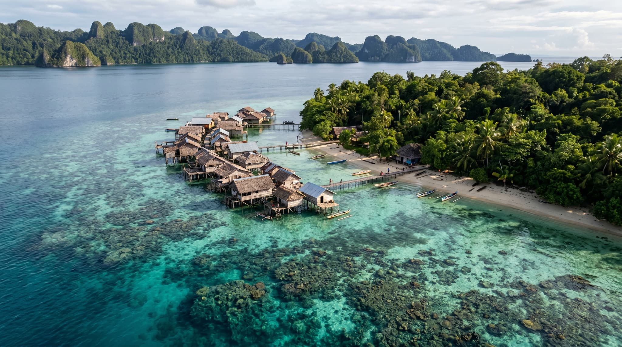
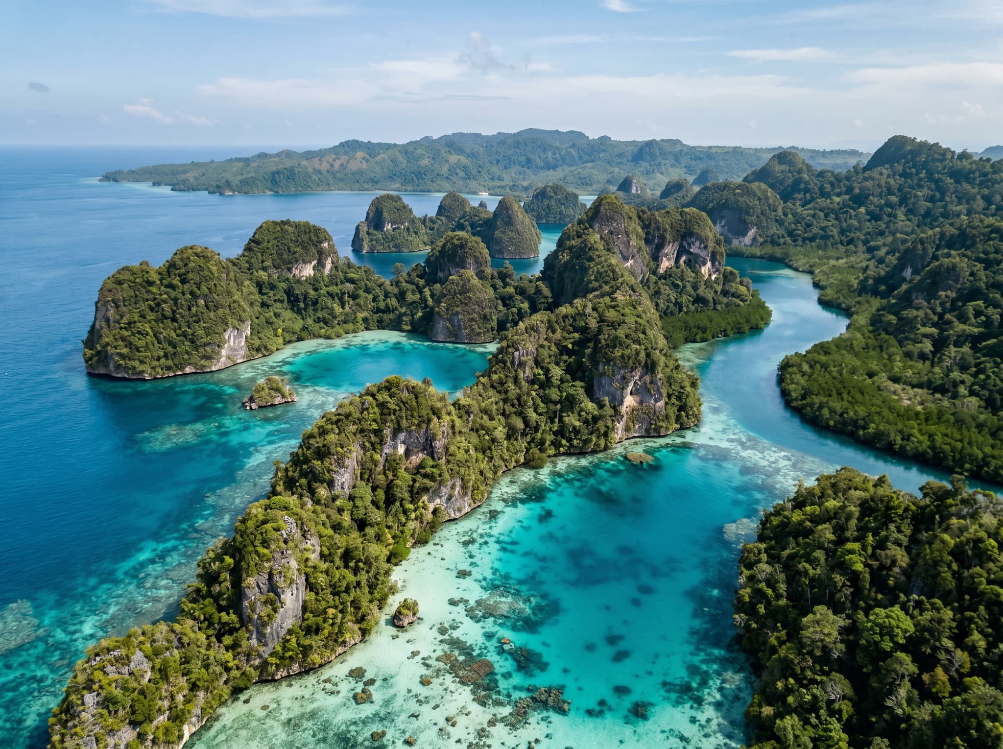
The experience is equal parts above and below the waterline. From the surface, the mangroves form dense green canopies that arch over narrow channels between limestone islets. Some of these channels are barely wide enough for a single kayak. Others open into small lagoons where the roots create cathedral-like formations reflected in the still water.
Below the surface is where the blue water mangroves earn their reputation. Snorkeling through the root systems reveals a density of marine life that rivals many of Raja Ampat's coral reef sites. Juvenile blacktip reef sharks patrol the shallows. Needlefish hover near the surface. Anemones attach to the roots alongside sponges and tunicates. It's a complete ecosystem compressed into a space you can cross in a few minutes.
For photographers, the interplay of light filtering through the canopy, the root structures, and the clear blue water below creates compositions that are genuinely difficult to find anywhere else in the world.
How to Visit
The most well-known blue water mangrove sites are located in the Yanggefo and Gam Island areas of central Raja Ampat, accessible by boat from most homestays and dive resorts in the Dampier Strait region. A typical visit is incorporated into a full-day island-hopping itinerary rather than treated as a standalone trip.
Getting There
Nearest Hub
Waisai (Raja Ampat's main town)
Boat Time from Waisai
45–90 minutes depending on site
Common Pairing
Combined with Pianemo viewpoint or Kabui Bay
Boat Charter Cost
IDR 2,500,000–4,000,000/day (~$155–$250) for a full-day trip
Most visitors arrive via a chartered longboat arranged through their homestay or resort. There's no dock or entrance gate — your boatman navigates into the mangrove channels directly. Some operators provide snorkel gear; others expect you to bring your own. Confirm this before departure.
Combining with Other Sites
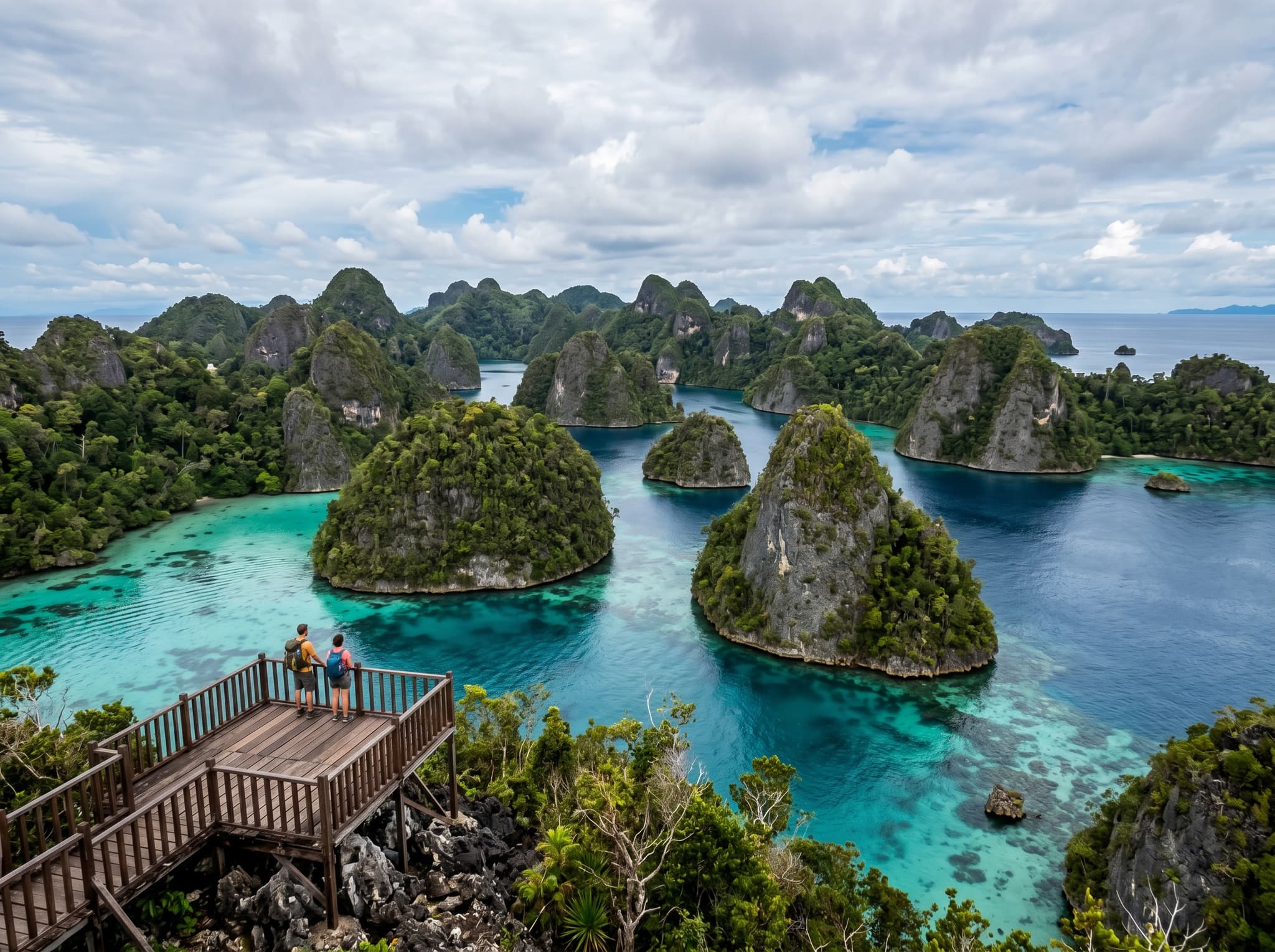
Blue water mangroves are almost always visited as part of a broader day trip. The most common combination routes include Kabui Bay's hidden lagoons and limestone passages, the Pianemo karst viewpoint (a steep climb rewarded with one of Raja Ampat's most iconic panoramas), and the Passage — a narrow waterway between Gam and Waigeo islands where the mangrove channels are particularly photogenic.
A well-planned day can cover two or three of these sites comfortably. Trying to cram in more than that usually means rushing through each stop, which defeats the purpose of being in a place this quiet.
Practical Considerations
Marine Entry Permit (MEP): All visitors to Raja Ampat's marine protected area need a permit, purchased at the conservation office in Waisai or at Sorong's port. This is a one-time fee valid for one year and funds conservation efforts across the archipelago.
Environmental etiquette: The mangrove root systems are fragile. Avoid standing on roots, grabbing branches to pull your kayak through, or touching marine life attached to the root structures. Reef-safe sunscreen matters here as much as it does on the reefs — these are connected ecosystems.
Skill level: You don't need to be an advanced snorkeler. The channels are shallow and protected from currents. However, basic comfort in open water is important since you'll be entering and exiting from a boat rather than wading in from a beach.
Why It Matters
Raja Ampat sits at the heart of the Coral Triangle, the most biodiverse marine region on Earth. The blue water mangroves are a visible, accessible reminder that this biodiversity doesn't just live on the reefs — it depends on the entire chain of connected habitats, from deep ocean trenches to these shallow, sunlit root systems where the next generation of reef fish begins.
The fact that they also happen to be strikingly beautiful is almost secondary. Almost.